Safe anchorage
Punta Crepazza: 38° 26′ 24″ N, 14° 57′ 5″ E
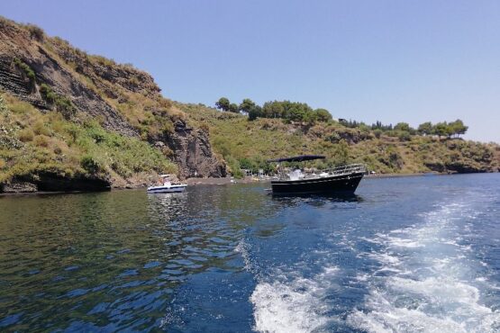
Berth opposite the beach of Praia di Vinci, rocky seabed, 12-15 m depth. Swell caused by the channel between the islands. Crowded in high season due to boats carrying tourists.
Breathtaking sunsets over the faraglioni rocks.
Please Note: Loggerhead sea turtles nest on the beach.
Praia da Vinci: 38°26’26.70″N14°57’5.89″E
This unspoiled paradise can be reached only by boat. Its main feature is its sandy shore with just a few pebbles. The beach runs along a coastline which is rich in inlets and bays that follow each other up to the castle rock in Lipari, not far from the harbour of Marina Corta.
Please Note: Loggerhead sea turtles nest on the beach.
Portinente: 38°27’37.44″N14°57’24.23″E
VHF: channel 73
Buoy Field: 40 seasonal buoys.
Maximum length: 18 m
Phone: +39 338 539 6531
The bay of Portinente is the most convenient for those wishing to moor in one of the harbors on the island of Lipari.
It is completely exposed to easterly winds. The seabed is sandy but quite deep.
Included in the charge for the buoy is a transfer service to the town until midnight. You can otherwise use your tender and dock at the fishing boat pier.
Marina Corta 38°27.98′ N14°57.55′ E
Radio: VHF channel 16 – 11 ( continuous service)
Access Time: Any time
Lighthouses and port lights: 3284 (E 1792) – white flash light, grp 3, cycle period 15 sec., range 14 meters
Seabed: sandy
Depth: from 0,50 to 6 m
Winds: Sirocco causes strong undertow.
Shelter: from III and IV quadrant winds
Closest safe anchorage: coastline between Punta Scaliddi and the bay of Portinente (depth 25/30 m sandy seabed)
Marina Corta harbor is made up of two opposite mooring areas: a larger north-facing one and a smaller south-facing one. These are protected by the north-eastern and south-eastern piers respectively. The north-eastern pier serves the entire larger area, while the smaller one is served by the south-eastern pier and the quay bordering Piazza S. Onofrio square.
Fuel – Eolian Bunker 38°28’17.09″N14°57’20.90″E
Working hours:: 8:00 – 13:00 – 16:00 – 20:00
Phone: +390909812335
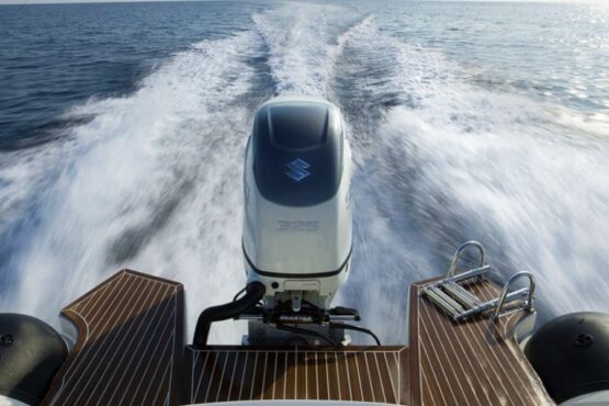
Eolian Bunker is a depot and fuel station for vessels and boats. Located in the bay of Marina Lunga, between Porto Pignataro and the harbor of Sottomonastero, it has a 50-meter jetty that allows vessels to dock. The company also offers bunkering with subsidized diesel for ships, hydrofoils and fishing boats. Duty free diesel is available for yachts sailing abroad.
Marina Lunga 38° 28.41’N 14° 57.51E
Radio: VHF channel 16 – 13 – 72.
Berths: 80 ( 2 docks with 40 berths)
Max length: 60 m
Winds: I and III quadrant
Side winds: I and II quadrant
Shelter: from III and IV quadrant winds
Access Time: any time
Seabed: sandy, muddy
Fondali: in banchina da 1 a 18 m.
Closest safe anchorage: “Valle Muria” Bay on the western coast of the island for side winds coming from S, SE, E and ENE.
Marina Lunga is located to the north of the harbor of Sottomonastero and includes the coastline from the latter to Pignataro harbor. The bay is exposed to winds coming from S, SE, E and ENE; it is an excellent anchorage for all other winds.
There are five docks located along this coastline from south to north: the floating dock managed by “La Buona Fonda”; the floating dock managed by “Yacht Harbour Lipari”: the electrical company jetty, the Agip jetty and the Eolian Bunker one; these last three are designated to the mooring of water and fuel tankers as well as all vessels bunkering at the fixed refueling stations. Mooring is forbidden to all other vessels (Order n°11/2002).
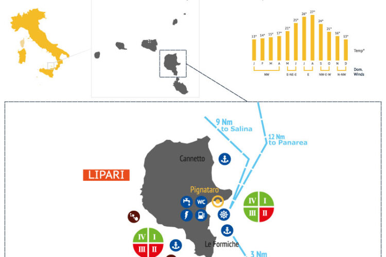
Marina Pignataro 38°28.55′ N, 14°57.88′ E
Radio: VHF channel 74
Radio: VHF channel 09 Eolmarę srl; VHF channel 07
Access Time: any time
Berths: 255
Maximum length: 45 m
Lighthouses and port lights: 3292 (E 1788) – green flashing light, cycle period 3 sec, range 8 m, at the head of the pier in Pignataro
Seabed: muddy, sandy
Depth: 3 to 5 m at dock
Interdiction: No mooring at the pier in Pignataro is allowed from the landward end of the pier and for 30 meters, which is reserved for military and police vessels.
Winds: sirocco, greco-tramontana.
Side wind: sirocco
Shelter: from I and II quadrant winds
Closest safe anchorage: halfway along the Monterosa promontory, east of the valley dividing the mount from the next hill (228 meters) about 180 meters from land (sandy seabed, 30/40 meters depth).
The sheltered harbor of Pignataro has an outer pier (275 m long and facing SW) with bollards and mooring rings, and a shore quay. The final part of the pier is reserved for ferries
Canneto 38° 29.15’N, 14° 58.21E
Radio: VHF channel 16
Access Time: any time
Lighthouses and port lights: 3292.5 (E 1792.7) – fixed green light, range 7 m, on the ferry pier.
Seabed: from 2 to 5 m
Depth: 2 to 5 m at dock
Danger: underwater rocks on 5.5 to 30-meter deep seabed between Unci and the pier in Canneto.
Interdiction: Do not use the steps along the peer for longer than embarkation/disembarkation
On the eastern coast of Lipari, in front of the island’s main town, lies a bay with deep waters below mount Monte Rosa.
The harbor of Canneto lies between Capo Rosso to the north and Monte Rosa to the south; there is a pier jutting out from the beach where ferry boats moor. It is possible to anchor to the west of the beach located north of Monte Rosa, taking care of the underwater cable area.
Papesca White Beach 38°29’56.04″N14°57’46.55″E
The volcanic nature of the Aeolian Islands is clearly tangible in this area. The seabed made up of pumice stone sediments makes it a unique attraction in the Mediterranean – a source of pride for Italy and a world heritage site. The sea is particularly warm, intense turquoise in color, dotted with jetties once used for the loading of the pumice that was quarried here.
Porticello 38°31.05′ N14°57.70′ E
Radio: VHF channel 16
Lighthouses and port lights: 3293 (E1793) – fixed red light, 2 vert, 3 m range, on the ex La Cava jetty; 3294 (E 1794) – fixed green and red lights, 2 vert, 3 m range on Pumex jetty.
Seabed: sandy, loose surface (bad hold)
Depth: 2 to 14 m
Winds: I and II quadrant
Side wind: NE, East, SE
Closest safe anchorage: with northerly winds you can anchor south of Monte Rosa, opposite Pignataro.
There are various jetties in Porticello. The most northerly is about 55 meters long and positioned to the south of Punta Castagna; it can be used only by passenger and cargo vessels. The other metal jetty belongs to Pumex SpA and is reserved for cargo ships.
Danger: beware of cargo ship lines around the Pumex n 2 jetty, which extend 250 m to the left and 400 m to the right towards the buoy positioned near Punta Castagna. These lines inhibit mooring at the jetty.
Spiaggia Porticello 38°31’4.28″N14°57’39.52″E
Porticello Beach lies a few kilometers north of Lipari town. It is a pebbly beach characteristically littered with pumice. There are many private beach clubs.
To the left of the sea lie the Campo Bianco quarries, to the right the contrasting black obsidian stone flow on Rocche Rosse.
Acquacalda Beac 38°3112.31″N14°56’49.84″E
The village of Acquacalda on the northern coast of the island gives its name to the neighboring beach.
It is dominated by the majestic white pumice mountain in the background, which is a rare, natural masterpiece. The pumice quarries here used to be the only ones in Europe after those in Turkey. The scenery is wild and unspoiled. Along the mostly pebbly beach lies a one hundred-meter long jetty. There are various beach establishments catering to tourists’ every need.
Cugno Lungo 38° 29.10′ N, 14° 54.00′ E
This is a bay surrounded by steep cliffs on the western coast of the island, not far from San Calogero. At the end of the bay is a pebbly beach; it is advisable to anchor 100 meters from it at a depth of 9-10 meters with sandy, seaweed and rocky bed.
Valle Muria Beach 38°27’37.06″N14°55’59.24″E
On the opposite side to Lipari town lies a beach that is considered one of the most beautiful in the Aeolian Islands, that is Valle Muria.
It has an elongated shape, enveloped by rocky promontories.
Notwithstanding its own natural beauty, its main asset is the view it offers. It could be seen by a painter as a window from which to admire the superb colors of the Faraglioni Pietra Lunga and Pietra Menalda and Vulcano.
The whole coastline is characterized by dark sand and tufa rocks.
Valle Muria 38° 27 50′ N. 14° 56.00′ E
This is a bay on the south western coast, surrounded by colorful cliffs and is a pleasant place to anchor, sheltered from northeasterly winds. It is possible to anchor 40 meters from the coast at a depth of less than 5 meters. The seabed is sandy and offers a good hold. Beware of the shoal at the extreme southern point
Sotto Monte 38° 26′ 58″ N. 14° 56′ 29″ E
Beautiful wide bay. Anchor at a depth of 7 meters. The seabed is sandy and offers a good hold. Breathtaking sunsets